
How Cloud-Based Data Management Benefits Large Infrastructure Projects
All graphics: Credit Donatsch + Partner AG.
Cloud technology is unlocking the value of huge reality capture datasets by enabling stakeholder collaboration and all-digital field-to-office-to-field workflows.
Data sharing and collaboration among multiple stakeholders, including government agencies, contractors, engineers and environmental experts, is a significant challenge for large infrastructure projects. Subsequent delays, miscommunications and inefficiencies can add to costs and negatively impact the quality of the deliverables.
Infrastructure projects today benefit greatly from data provided by reality capture solutions in mobile mapping, UAV, 3D laser scanning and scanning total stations but face ongoing difficulties when managing large datasets, resulting in missed opportunities. The development of cloud-based platforms, however, is revolutionizing the way these projects are managed by offering a streamlined and collaborative approach that can significantly enhance productivity and support better decision-making.

As-built 3D-model of the existing, 120-year-old Bergünerstein Tunnel. All graphics: Credit Donatsch + Partner AG.
Cloud Technology Adds Value to Reality Capture Data
Moving reality capture data among stakeholders traditionally involves physically transferring the data on hard drives or USB sticks to multiple offices. As additional copies are created and changes and updates are made in various locations, the probability of people working on different versions of data increases, along with the risk of errors and misunderstandings. In addition, technical expertise, complex desktop software and high-performance computing hardware are required to work with data and extract information, which limits access and creates data silos.
The power of a cloud-based platform lies in its ability to facilitate data sharing among multiple stakeholders while providing one source of truth. Unlike traditional methods that rely on physical media or email attachments, cloud-based platforms allow data to be stored and accessed remotely, enabling real-time collaboration and direct communication. This setup streamlines decision-making processes and promotes data democratization, ensuring everyone can access the same information and contribute to the project’s success. With comprehensive data retained in the cloud, it is also readily available for future work such as maintenance and upgrades, which reduces costs and improves the return on investment.
This seamless data exchange eliminates the risks associated with data loss, corruption and version control issues. Additionally, cloud-based platforms offer robust security measures, such as encryption and access controls, ensuring sensitive data is protected and compliance with industry regulations is maintained. Using cloud technology provides the stewards of the data with opportunities to retain all original data in a secure central location while efficiently managing assets throughout the entire lifecycle of an infrastructure project.

In Trimble Connect, a colorized point cloud was compared to the design to identify areas that required rework. All graphics: Credit Donatsch + Partner AG.
Leveraging Big Data and AI Technology for Infrastructure
While cloud technology has been instrumental in geospatial data for applications like tracking fleets of cars and IoT, reality capture data poses a unique challenge due to the extremely large file sizes. As infrastructure projects become more complex and data-intensive, advanced data analysis and decision support tools are increasingly crucial. The adoption of mobile mapping sensors and laser scanning technologies enables the capture of vast amounts of rich data, including dense point clouds and panoramic imagery. However, the sheer volume and complexity of the data can make it challenging to extract meaningful insights and actionable information.
Traditionally, the process of classifying and extracting features from point clouds and 3D models has been a tedious and time-consuming task, often requiring manual intervention and specialized expertise. More recently, the integration of artificial intelligence (AI) and machine learning algorithms into cloud-based platforms has streamlined this process, enabling automated feature extraction, classification, and analysis at an unprecedented scale.
AI algorithms can be trained to recognize patterns, identify objects, and extract relevant features from vast amounts of reality capture data, significantly reducing the time and effort required for manual analysis. Automation enhances efficiency and improves the accuracy and consistency of data interpretation, leading to more informed decision-making and better project outcomes.
To make very large reality capture datasets securely accessible to all project stakeholders, without needing specialized geospatial software and point cloud expertise, Trimble recently announced the release of Trimble Reality Capture platform service as an extension to Trimble Connect®, a cloud-based common data environment and collaboration platform that supports more than 30 million users.

Parametric Tunnel Definition prepared with Trimble Business Center Tunneling module. All graphics: Credit Donatsch + Partner AG.
The service leverages Microsoft Azure technology to reduce the time ingesting, storing and processing massive datasets. The service is designed to optimize and synthesize reality capture data of all sizes across Trimble connected software solutions, as well as third-party system integrators. Developers placed a strong emphasis on retaining data integrity to ensure investments made in high accuracy sensors and data acquisition can also be leveraged in the cloud. Viewing, sharing and downloading comprehensive data enables project stakeholders to make more informed decisions and increase operational efficiency by further connecting the site to the office on complex reality capture projects.
These advances in cloud computing and storage capabilities are paving the way for more efficient handling and processing of point clouds and 3D models in the cloud and expanding opportunities to produce digital-based models for users in building construction, surveying, transportation infrastructure, utilities, energy, mining and more.
While AI tools for data analysis are already available in non-cloud applications, combining cloud technology with AI capabilities will unlock the true power of reality capture data. By storing, processing, and analyzing reality capture data in the cloud, stakeholders can leverage the scalability and computational resources of cloud platforms, enabling real-time collaboration, data sharing, and advanced analytics.

As-built cross sections are measured by the construction company in the field using the Trimble Access Tunneling Module. The Tunnel As-Built Report can be exported directly from the controller. All graphics: Credit Donatsch + Partner AG.
Long-Term Impacts of Cloud Technology
Cloud-based platforms have the potential to transform the way large infrastructure projects are managed and executed, and the long-term impacts will carry through the entire lifecycle.
- Planning and design – As part of the planning and design phase of a project, cloud technology can provide powerful visualization and reporting tools, enabling stakeholders to visualize and interact with 3D models, point clouds, and other data types. Convenient collaboration aids in the identification of potential issues, design flaws, or environmental impacts. By re-using the original data, augmented reality systems like Trimble SiteVision can help to visualize expansion and upgrades to existing infrastructure in the future.
- Construction – During this phase, cloud technology removes the limitations on data storage and distribution and supports more frequent data collection, such as weekly UAV capture of the entire work site and spot scans as construction proceeds. For example, after laying concrete or blasting rock, engineers can complete a scan, create a measurement, and compare the measurement to the model to verify everything is correct before continuing. Improved usability of tools such as the Trimble X9 laser scanning system allows registration in the field, which reduces processing time in the office and means that up-to-date data can be made available more quickly via the cloud.
- Maintenance – After the asset is built, maintaining all associated data in the cloud, rather than residing on one person’s desktop, enables more people to extract value through multiple applications. The point cloud can be filtered to remove noise and extract layers such as vegetation and ground, while features like manholes and signs can be extracted and labeled. The data can be turned into a 3D model that contains maintenance information that is connected to a work order system.
- Future Projects – More customers have started requiring contractors to conduct their business in a digital environment to provide an opportunity to re-use the data and increase the return on investment. The contractor remains connected to the project because they have all the data preserved, making them a likely candidate for future construction work, environmental reviews, and repairs.
Use Case: Cloud-Based System Expedites Tunnel Retrofit
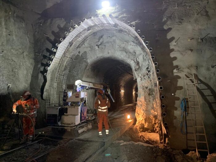
The benefits of using cloud-based common data environments (CDEs) in complex construction projects are evident in the renovation of the Bergünerstein Tunnel in Switzerland. The project, which involved retrofitting and enlarging a century-old 409-meter tunnel to meet current safety standards, faced significant schedule pressures and stringent accuracy requirements.
To address these challenges, Donatsch + Partner AG, a Swiss surveying company, adopted a cloud-based workflow using Trimble Connect, a CDE and collaboration platform. This integrated approach was new for Donatsch, the prime contractor Rhomberg Bahntechnik AG, and the design company Amberg Engineering AG. The cloud-based system enabled seamless data transmission and easy access to the most current design information for all stakeholders.
Amberg created the tunnel design using Revit, a building information modeling software, and loaded the 3D model directly into Trimble Connect. This centralized data approach resulted in efficient management of design updates, expedited volume calculations, improved comparisons of as-builts to design, facilitated communication between stakeholders, and enabled faster, transparent decision-making.
Donatsch utilized Trimble Sync Manager to interface between Access and Connect, allowing syncing in the cloud of field measurements collected overnight so they were ready for the office crew in the morning. This streamlined workflow allowed for timely analysis and quick error detection. For instance, when the construction crew once used the wrong target model on their total station, the error was caught and fixed the next day before any problems occurred.
Donatsch was responsible for calculating excavation and shotcrete volumes, creating profiles for over and under excavation analysis, and comparing as-built measurements to the model. By loading a colorized 3D point cloud into Trimble Connect, the team could easily visualize areas needing correction, with different colors indicating the status of the work.


Set-out points for the concrete precast elements of the railway were exported from the BIM model and used as an overlay in Trimble Access to view on the Trimble T10 tablet. All graphics: Credit Donatsch + Partner AG.
Fadri Jecklin, Project Manager at Donatsch, emphasized that Trimble Connect enabled effective communication of survey work and progress with contractors, shortening decision-making time and increasing confidence in meeting specifications. The cloud-based workflow made up-to-date information available to all stakeholders, supporting early detection of planning and construction errors and helping meet stringent timelines.
Donatsch found that the open interfaces made possible by the cloud provided flexibility to use the best hardware and software for each job without worrying about data compatibility between vendors. As a beta tester for Trimble’s Tunneling group, they also had the opportunity to provide feedback and benefit from improvements that streamlined their workflow.
The success of this approach in the Bergünerstein Tunnel project led Donatsch to adopt cloud-based workflows as standard practice on all their larger projects. They found it to be much more efficient than traditional methods of communication through email and file-sharing platforms like Dropbox. The ability to upload various file formats into the cloud ensured comprehensive data was always available when needed, and calculations and analyses could be easily disseminated.
The adoption of a cloud-based CDE in the Bergünerstein Tunnel project demonstrated significant benefits in terms of improved communication, reduced errors, enhanced project transparency, and improved accuracy in calculations and comparisons.
Conclusion
By leveraging the power of cloud technology, geospatial data sharing, and collaboration, as well as the integration of AI and advanced data analysis capabilities, these platforms offer a comprehensive solution that retains data integrity, streamlines workflows, enhances decision-making, and ultimately contributes to the successful delivery of complex infrastructure projects.
About Gregor Willhauck
Gregor Willhauck is Cloud Solutions Market Manager at Trimble Geospatial. He has been with Trimble since 2010 and has more than 20 years of experience in hardware and software product management.
