
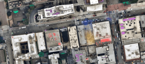
Developers can access maps with layers featuring key datasets such as tree overhangs (green), solar panels (purple), buildings under construction (yellow), construction sites (blue) and roofs with permanent repair (red). (Image credit: Nearmap) With…

Infrastructure Outlook: Geographic Information Systems: A Tool for Innovative Governing
Geographic Information Systems (GISs) are powerful technology tools used across various sectors, including utilities and commercial industries, to…
