
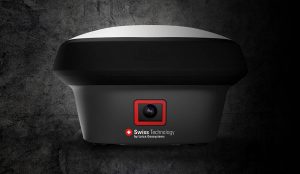
New GS18 I GNSS RTK rover with Visual Positioning can measure what you see (HEERBRUGG, SWITZERLAND, 18, August 2020) – Leica Geosystems, part of Hexagon, unveils the Leica GS18 I (announced by Hexagon yesterday), a versatile, GNSS RTK rover with Visual…
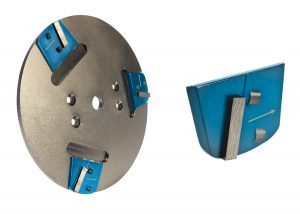
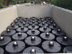
General Equipment Company Introduces MAGNETACH Line of Surface Preparation Accessories
OWATONNA, Minn. – General Equipment Company is rolling out its MAGNETACHÒ Tooling System, which is designed for use on single- and dual-head concrete…
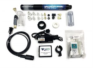
Q.E.D. MicroPurge MP25 Simplifies Low-Flow Groundwater Sampling
Purge stabilization flow cell ensures accuracy and consistency Dexter, MI – Q.E.D. Environmental Systems, Inc., a leading manufacturer of innovative…
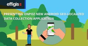
Geo-localized data collection now made easy with new OnPOZ Collect app for Android
Effigis is proud to announce the worldwide launch of its new OnPOZ Collect and Cloud solution, for efficient geo-localized fieldwork data collection and management. OnPOZ Collect is a powerful GIS mapping app that transforms a phone or tablet into a geospatial…
Contech® Stormwater Management StormFilter® Achieves ISO 14034 Environmental Technology Verification (ETV)
West Chester, OH – Contech® Engineered Solutions announced today that the Stormwater Management StormFilter® has been verified in accordance with ISO 14034 Environmental Management - Environmental Technology Verification (ETV). Data from both laboratory…

New MapleMBSE release from Maplesoft expands support to include Capella
MapleMBSE 2020.2 offers expanded toolchain connectivity, improved performance and usability Waterloo, Canada: Maplesoft™ today announced a new release of MapleMBSE, the software that enables companies to implement Model-Based Systems Engineering (MBSE) processes…

Enhanced geology and mine design in Vulcan 2020
Desktop tools that enable mining professionals to interact with their data are the building blocks upon which Maptek innovation was founded. Almost 40 years on from the early borehole modelling tools, Maptek has this week released Vulcan 2020, featuring integrated…
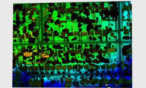
Teledyne Optech extends its innovative airborne lidar sensor series with new corridor mapping model
The new Galaxy CM2000’s small laser footprint allows for detection of fine corridor features Vaughan, CANADA ─ Teledyne Optech, a Teledyne Technologies [NYSE:TDY] company and global leader in advanced lidar sensors has extended its bestselling Galaxy lineup…
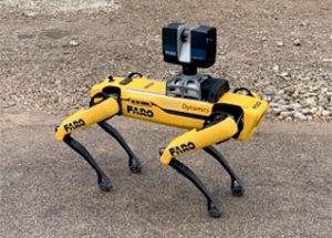
FARO® Launches Trek, the Automated 3D Laser Scanning Integration with Boston Dynamics Spot® Mobile Robot
Lake Mary, FL, August 5, 2020 – FARO Technologies, Inc. (NASDAQ: FARO), the global leader for 3D Metrology, AEC and Public Safety Analytics, today announced the release of FARO® Trek. Trek is a fully autonomous 3D mobile scanning integration built…

Autodesk and Aurigo Software Combine the Power of their Products to Drive Productivity Across Capital Projects
Integration between Autodesk Construction Cloud and Aurigo Masterworks will strengthen collaboration between capital owners and contractors AUSTIN, Texas — Aurigo Software today announced the first in a series of planned product integrations with Autodesk…
