
MUNICH, Germany – NavVis, a global leader in mobile indoor mapping, visualization, and navigation, announces new mapping software that significantly improves the accuracy of simultaneous localization and mapping (SLAM) technology in indoor environments,…

Pettibone Introduces Next Gen T944X Telehandler With Industry-Exclusive Traversing Boom
BARAGA, Mich. — The new Pettibone Traverse T944X is the industry’s only new telehandler with an extendable, traversing boom that moves loads by traveling…
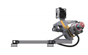
Leica Geosystems Introduces Latest in Linear Mode LiDAR
Heerbrugg, Switzerland – Leica Geosystems, industry leader in measurement technology, announced today the launch of TerrainMapper, its next generation…
Trimble Announces New MX9 Mobile Mapping System for Surveying, Engineering and Geospatial Professionals
SUNNYVALE, Calif —Trimble (NASDAQ: TRMB) announced today the release of the Trimble® MX9 mobile mapping solution. The Trimble MX9 combines a vehicle-mounted mobile lidar system, multi-camera imaging and field software for efficient, precise and high-volume…

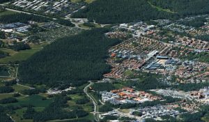
Leica Geosystems Multipurpose Mobile Mapping Platform Increases Smart City Applications
Heerbrugg, Switzerland – Leica Geosystems, industry leader of measurement technology, released today the new Leica Pegasus:Two Ultimate, an upgrade to its current mobile mapping platform bringing higher quality digital reality capture to the market. …
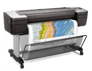
HP Launches the World’s Most Secure Large Format Printers for GIS mapping
PALO ALTO, Calif. — HP Inc. today introduced HP DesignJet T1700 printers, next-generation 44-inch solutions for CAD and geographic information system (GIS) workgroups to produce highly accurate documents and maps with powerful processing and a new…
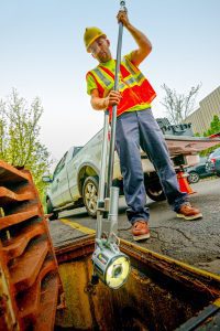
Envirosight Releases New Quickview airHD+ Sewer Assessment Camera
RANDOLPH, NJ— Zoom assessment cameras are used to help determine sewer condition, and the Quickview brand revolutionized the sewer inspection industry by providing rapid, affordable visual assessment capabilities in sewer lines, stormwater lines, catch basins…
Woolpert Updates SmartView Connect to Publish Mapping Data at Unprecedented Speeds
DAYTON, Ohio — Woolpert has launched the SmartView Connect (SVC) Version 5, a streamlined quality assurance/quality control (QA/QC) tracking application to review preliminary imagery, elevation and remote sensing data sets. SVC is an open geospatial…
Trimble Expands Mixed-Reality Portfolio for Field Workers
SUNNYVALE, Calif., Jan. 25, 2018-Trimble (NASDAQ: TRMB) announced today Trimble Connect™ for HoloLens and a new hard hat solution for Microsoft HoloLens that improves the utility of mixed reality for practical field applications. The announcement was made…
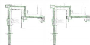
Bentley Systems Expands Concrete Building Design and Documentation Offerings through Acquisition of S-Cube Futuretech
EXTON, Pa. — Bentley Systems, Incorporated, a leading global provider of comprehensive software solutions for advancing infrastructure, today announced the acquisition of Mumbai-based concrete building design and documentation software company S-Cube Futuretech…
