

HAMBURG, Germany - Trimble (NASDAQ: TRMB) introduced today its new Trimble® TX6 and improved TX8 high-performance 3D laser scanning solutions. With a fully integrated High Dynamic Range (HDR) camera and Wi-Fi remote control, the high-speed 3D laser scanners…
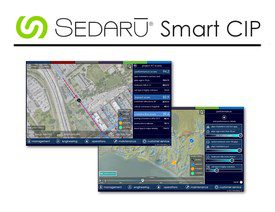
Sedaru Deploys Smart CIP, Advancing the Connected Utility, Empowering Integrated, Dynamic Asset Management for Water/Wastewater Systems
ARCADIA, Calif. - IDModeling, Inc. the leading global provider of smart water software and services, announced today the deployment of Smart CIP™ for…
TomTom’s HD Map Powers Autonomous Driving
MELBOURNE, Australia - ITS World Congress – TomTom (TOM2) today announces a joint autonomous driving demonstration with Bosch. TomTom provided its HD…
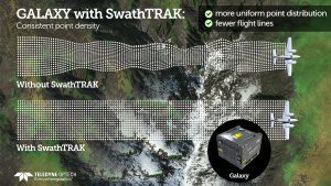
Teledyne Optech Announces New Efficiency Enhancement for ALTM Galaxy Wide-Area Lidar Mapping Sensor
Teledyne Optech is pleased to announce a high-performance scanner update to its innovative line of airborne laser terrain mappers, the Optech Galaxy ALTM™. The Galaxy’s scan efficiency has been engineered to deliver an additional 30% boost to its class-leading…
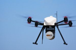
InterGEO2016: AltiGator and YellowScan Unveil a 5.6kg Survey-Grade LiDAR UAV all Integrated System, Ideal for Centimetric Urban Surveys
AltiGator and YellowScan are pleased to announce an ultra-light weight LiDAR UAV combo allowing for the first time centimetric UAV surveys in urban areas, in accordance with most regulations. The YellowScan Surveyor ultra-light stand-alone LiDAR system is…
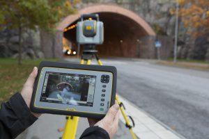
Trimble Unveils SX10 Scanning Total Station for Surveying, Engineering and Geospatial Professionals
SUNNYVALE, Calif., - Trimble (NASDAQ: TRMB) unveiled today a next-generation survey instrument—the Trimble® SX10 Scanning Total Station. It merges high-speed 3D scanning, enhanced Trimble VISION™ imaging technology and high-accuracy total station measurements…
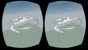
Autodesk LIVE now supports HTC Vive or Oculus Rift
Autodesk brought “on demand” interactivity to the architecture, engineering and construction (AEC) industries when we introduced Autodesk LIVE for Autodesk Revit in July. LIVE is the game-changing, cloud-based service that transforms your Revit model into…
senseFly to Unveil New RTK/PPK-Ready, Large Coverage Mapping Drone at INTERGEO 2016
Cheseaux-Lausanne, Switzerland – senseFly, the world’s first choice producer of professional mapping drones, will introduce its next-generation fixed-wing system for survey-grade photogrammetric mapping, the eBee Plus, at INTERGEO 2016 on Oct. 11 in…

DTS and SmarterBetterCities Partnership Extends 3D to Asset Management
San Francisco, Calif. – DTS and SmarterBetterCities are pleased to announce a partnership that brings 3D tools and sharing to asset management. The world is not flat. Why run an asset management system that only allows you to track work management, perform…
Contech’s UrbanGreen Rainwater Harvesting Tank Receives Uniform Plumbing Code Certification
WEST CHESTER, Ohio, Oct. 3, 2016 - West Chester-based Contech Engineered Solutions announced today that the UrbanGreen Steel Reinforced Polyethylene Rainwater Harvesting Tank has been certified to be in compliance with the Uniform Plumbing Code (UPC®) by…
