

Lake Mary, FL - FARO® (NASDAQ:FARO), the world’s most trusted source for 3D measurement and imaging solutions for factory metrology, product design, construction BIM/CIM, public safety forensics and 3D solutions and services applications, announces the…

FARO Releases SCENE Version 6.1, Introducing a Fully Integrated Point Cloud to 3D Mesh Engine for Product Design and Construction BIM-CIM Professionals
LAKE MARY, Fla. - FARO® (NASDAQ: FARO), the world's most trusted source for 3D measurement and imaging solutions for factory metrology, product design,…
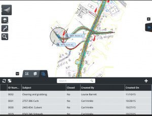
Bringing the Civil Engineering Office to the Field Speeds Approvals and Helps Resolve Issues During Design, Construction, and Operations
Bentley Systems announces OpenRoads Navigator CONNECT Edition, an innovative application that provides civil and transportation professionals an easy-to-use,…

Trimble Connected Mine Provides Spatial Data Visualization Using Trimble and Microsoft Mixed-Reality Technologies
SUNNYVALE, Calif. —Trimble (NASDAQ:TRMB) announced today the release of its Trimble® Connected Mine™ Visual Intelligence module with support for mixed-reality technology including Microsoft HoloLens to provide visual collaboration of mine spatial data.…
Buckeye Mountain and Trimble Partner to Bring Mobile Computing, GPS and AEI Tag to Railways
NIWOT, Colo.- Buckeye Mountain and Trimble have been working together in an effort to provide the railroad industry with products that meet their specific needs for mobile computers, AEI (railcar automatic equipment identification tags) and GPS. Trimble's…
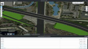
Quickly Produce Conceptual Roadway Designs
Bentley Systems announces OpenRoads ConceptStation, a conceptual modeling application that empowers highway engineering professionals to quickly create conceptual road and bridge models in a matter of hours – not days. OpenRoads ConceptStation enables rapid…
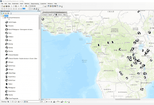
Exprodat Increases Oil & Gas Workflow Integration with Updated Data Assistant
Exprodat, the oil and gas ArcGIS platform specialist, Esri Gold Partner and Getech group company, has released the latest version of its popular Data Assistant software, which simplfies and speeds up the process of importing and exporting common exploration…

UTGIS Launches Mobile Electrical Safety Testing for IEEE 1695™ Contact Voltage Programs
PORT ST. LUCIE, Fla., — Utility Testing and Geographic Information Systems (UTGIS) announced today the launch of their Mobile Electrical Safety Testing (MEST) program. The MEST program is designed for utilities and municipalities interested in identifying…
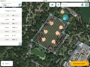
Datumate Unveils DatuFly, A Professional Imagery App for Drones
YOQNEAM, Israel, September 6, 2016 - Datumate, a market leader of automated "Field-to-Plan" solutions that save costly field and office time, is pleased to announce a new tablet app for effortless drone flight planning and automated, high resolution photo-shooting.…
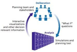
RAND and Lawrence Livermore National Lab Combine High Performance Computing and Public Policy Analysis for Demonstration of Water Resource Management
Researchers from the RAND Corporation and the Lawrence Livermore National Laboratory have joined forces to combine high-performance computing with innovative public policy analysis to improve planning for particularly complex issues such as water resource…
