
Enhancements to Esri’s Platform as a Service Will Help Developers and Businesses More Efficiently and Securely Build Solutions REDLANDS, Calif.— In 2021, Esri, the global leader in location intelligence, released ArcGIS Platform, a geospatial platform…

Introducing Autodesk AI for Design and Make
LAS VEGAS, Nov. 13, 2023 – AUTODESK UNIVERSITY –Autodesk, Inc. (NASDAQ: ADSK) today announced Autodesk AI, technology that unlocks creativity,…

Esri’s ArcGIS Basemaps and ArcGIS Living Atlas Data to Be Integrated into Autodesk Software Environment
AEC Professionals Will Have Access to Esri’s Rich, Authoritative Geospatial Reference Data with Autodesk Product Suite REDLANDS, Calif. — Digital…

Introducing Felt 2.0: The Most Powerful Tool for Professional Map Making
With spatial analysis and web-based collaboration, Felt makes maps easier and more accessible to organizations, empowers better decision-making for GIS professionals November 13, 2023--OAKLAND, Calif.-- Felt, the world’s first collaborative mapping…

Lenovo Unleashes Performance with ThinkStation P8 Powered by AMD Ryzen Threadripper PRO 7000 WX-Series Processors and NVIDIA RTX Graphics Cards
November 13, 2023 – Today, Lenovo™ announced the new ThinkStation™ P8 tower workstation powered by AMD Ryzen™ Threadripper™ PRO 7000 WX-Series processors and NVIDIA® RTX™ GPUs. Designed to deliver unparalleled performance,…

New Emerson High-Flow Solenoid Valve Increases Plant Reliability and Operating Efficiency
ASCO Series 327C solenoid valve features direct-acting, high-flow design for superior flow control performance and operational certainty Emerson has introduced the new ASCO™ Series 327C solenoid valve, which features a direct-acting, high-flow…
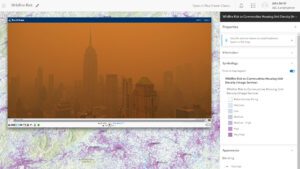
EarthCam Premieres Live Camera Integration with Esri ArcGIS Online
Live streams have many important geospatial use-cases - climate change, crime, active construction and more Live views enable visual verification within Geographical Information Systems (GIS) LAS VEGAS – EarthCam, the leader in live camera technology,…
Introducing vSite: The Geospatial Digital Twin Transforming Construction Sites
Toronto, November 13, 2023 – Today marks a significant leap forward in connected construction as vGIS unveils vSite, an innovative AR & AI-powered digital twin designed to revolutionize how construction sites are managed and completed. By integrating…
New OverIT Field Service Management Capabilities Streamline Operations
Mobile GIS redlining capability takes field service management software to a new level (Boston, USA) – OverIT, a leading provider of Field Service Management (FSM) software solutions, has added mobile redlining GIS capability to its industry leading…

Trimble Introduces Next Generation MPS566 Modular GNSS Heading Receiver
Trimble announced today its next generation Global Navigation Satellite System (GNSS) receiver for marine construction and drilling and piling operations—the Trimble MPS566 Modular GNSS heading receiver. With built-in dual GNSS antenna ports and constellation-agnostic…
