
(Heerbrugg, Switzerland) Leica Geosystems, part of Hexagon, today announced the launch of Leica iCON gps 160 — a significantly enhanced, next-generation construction Smart Antenna with features that increase productivity in all stakeout and measurement applications…

Brokk to Showcase New Innovations at Bauma 2022
The Brokk Grapple Saw 15 is two attachments in one. It can cut metal pipes with a diameter of up to approximately 200 millimeters (7.87 inches) and grab…

Vexcel Imaging unveils its new UltraNav version 7 including a new partnership with TopoFlight
Graz, Austria: From the Intergeo 2022 in Essen, Germany, Vexcel Imaging introduces the next version of UltraNav, its all-in-one Flight Management…
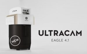
Vexcel introduces new UltraCam Eagle 4.1 photogrammetric aerial camera
Graz, Austria: Vexcel Imaging today announces the release of the new UltraCam Eagle 4.1, the pinnacle of nadir photogrammetric aerial camera systems increasing flight efficiency at truly mapping-grade image quality for precise analysis and interpretation.…
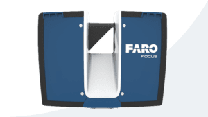
FARO Releases Focus Core Laser Scanner
Lake Mary, Fla – FARO® Technologies, Inc. (Nasdaq: FARO), a global leader in 4D digital reality solutions, today announced the release of the FARO® Focus Core Laser Scanner. The new Focus Core broadens the Focus family’s potential…
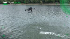
TOPODRONE advances airborne bathymetric surveying with AQUAMAPPER launch at INTERGEO 2022
Montreux, Switzerland – TOPODRONE, a Swiss based designer and manufacturer of high-precision LiDAR equipment for installation on drones, vehicles and backpacks, launches AQUAMAPPER, a UAV-based solution for bathymetric surveying and marine construction.…
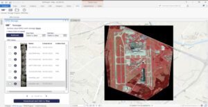
UP42 Launches ArcGIS Pro Add-in as Part of Esri Partner Network
ArcGIS users have direct access to the UP42 platform for easier data visualization and analysis BERLIN, Germany – UP42 made the first major announcement of its new partnership with the introduction of the UP42 ArcGIS Pro Add-in. Available on the Esri…
Emesent launches three time saving products for geospatial professionals
Hovermap ST-X, the newest edition of Emesent’s award-winning Hovermap autonomy and mapping device, captures detailed, accurate data over a greater area in less time. Hovermap ST-X, Long Range Radio, and Emesent’s Aura software platform were…
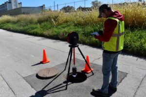
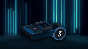
Aries Industries Bolsters Product Offerings With Addition of RinnoVision Manhole Inspection Solutions
Company’s camera system provides safe, highly-efficient infrastructure inspections CONTACT: Jim Kraschinsky, Aries Industries, (262) 446-5620, Jim.Kraschinsky@ariesindustries.com Waukesha, Wis. – Aries Industries, the industry leader in state-of-the-art…
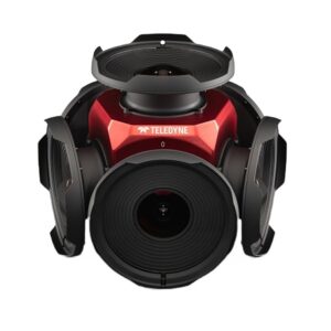
Teledyne announces new Ladybug6 cameras for high accuracy 360-degree spherical image capture
Richmond, CANADA ─ Teledyne FLIR Integrated Imaging Solutions is pleased to announce the all new Ladybug6— the latest addition to its field proven Ladybug series. Ladybug6 is the leading high-resolution camera designed to capture 360-degree spherical…
