
Autodesk BIM 360 Design, part of Autodesk Construction Cloud, continues to add critical features and services, including a new Europe-based data center offering for primary storage of product data, and a connection to Collaboration for…

AIA task force launches tool for assessing COVID-19 alternative care sites
Tool is intended to assist non-healthcare design professionals with identifying alternative sites suitable for patient care. Washington - As communities…
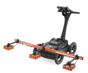
GSSI Releases PaveScan® RDM 2.0 Asphalt Density Assessment Tool
GSSI, the world’s leading manufacturer of ground penetrating radar (GPR) equipment, announces PaveScan® RDM 2.0 – an innovative asphalt density assessment…
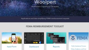
Woolpert, Esri Develop Free Airport FEMA Reimbursement Application
The application will help airports submit forms to expedite FEMA reimbursements. DAYTON, Ohio (April 3, 2020) — Woolpert and Esri have partnered to develop a free, user-friendly application to help airports enter, track and submit reimbursable…
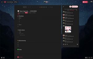
Taskade: Real-Time Collaboration Platform Launches Free Pro During COVID-19
San Francisco, CA — Taskade, a Y-Combinator backed startup, launches a real-time organization and collaboration platform for distributed teams. This week, it announced it will be offering a 6-month free upgrade to its Pro version to support businesses and…

elec calc™ 2020: Electrical Calculations Made Easy
Trace Software International announces that the latest version of elec calc™ is already available on the market. The software guarantees the optimal sizing and the calculation performance in real-time of any electrical installation. The newest…
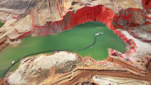
Newest Virtual Surveyor Software Highlights Dangerous Slope Angles in Sand Pits, Quarries, Escarpments
Focus on Safe Operations AARSCHOT, Belgium – Virtual Surveyor has introduced a new feature in Version 7.2 of its popular drone surveying software that automatically highlights terrain slopes that exceed dangerous steepness thresholds. Called Slope Threshold…
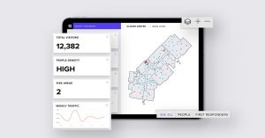
InnerSpace Announces inFORCE Public Health & Safety Solution
Indoor location platform provides municipalities with emergency response and public safety solutions on existing WiFi networks TORONTO (ON) - InnerSpace, the world’s most accurate WiFi-based indoor location intelligence platform, today announced its product…

Leica Geosystems announces new 3D laser scanning bundle
Leica Geosystems, a Hexagon company, announced today a new 3D laser scanning bundle for the BLK360 and greater integration with Autodesk ecosystem. HEERBRUGG, Switzerland – Leica Geosystems, a Hexagon company, announced today a new 3D laser scanning…

Plexscape’s response to COVID-19 pandemic: Free Plex.Earth licences for remote working
In response to COVID-19 pandemic, Plexscape, developers of Plex.Earth®, one of the most popular AutoCAD tools for the acceleration of architectural, engineering and construction (AEC) projects, is doubling its customers’ licenses at no extra cost, for…
