

Montreal, Canada, April 9th, 2019 – SimActive Inc., a world-leading developer of photogrammetry software, announces that Correlator3D™ is being used for mapping projects in Brittany, France by Altimedias. An eBee X equipped with senseFly S.O.D.A.…
NDOT Announces Website For Flooding Information
LINCOLN — The Nebraska Department of Transportation (NDOT) recognizes the importance of restoring our transportation network to Nebraskans who rely…
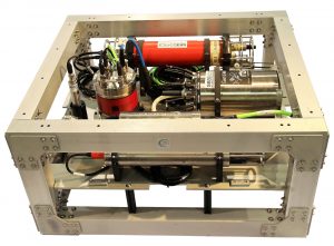
2G Robotics and Seatronics Partner to Launch New Dynamic Laser Scanning Skid Solution at Ocean Business 2019
WATERLOO, CANADA – 2G Robotics, a global leader in underwater laser scanners and imaging solutions for the Offshore Energies, Geosciences and…

IMAGINiT Technologies Earns Sixth Consecutive Autodesk Platinum Club Award
BALTIMORE, MD — IMAGINiT Technologies earned an Autodesk Platinum Club Award for the sixth straight year due to their efforts helping customers select the right Autodesk product collections to achieve their business goals. The team accepted the prestigious…

Silicon Valley Clean Water Selects Microsoft Tools to Power First Tunneling Progressive Design Build in the U.S
Silicon Valley, California— Silicon Valley Clean Water’s (SVCW) RESCU program is paving the way for the future of wastewater management and capital improvement upgrades using Microsoft’s collaborative tools and other contemporary technology for its complex…

Elec Calc™ 2019 Is Now Available: Enhanced Operational Efficiency
Trace Software International, the leading engineering company with unique expertise in the electrical industry, announces the launch of the latest version of elec calc™. elec calc™ is the software solution dedicated to the sizing of electrical…

Introducing AutoCAD 2020: See What’s New
We’re thrilled to bring you AutoCAD 2020, packed with new features and enhancements to help you design, draft, and bring visions to life. With a subscription to AutoCAD including specialized toolsets, you’ll gain access to industry-specific specialized…

GeoDecisions Develops PennDOT Connects Mapping & Collaboration Portal
(Harrisburg, Pa.) GeoDecisions®, an international geospatial technology company, has completed the development and launch of the Pennsylvania Department of Transportation’s PennDOT Connects Application. The web-based application was created to enhance cooperation…

First-of-its-Kind Interactive Calculator Enhances Tensar SpectraPave Software
Tensar International has released a major update to its established SpectraPave Software that lets designers, contractors and owners assess the complete short and long-term costs of pavement design options. SpectraPave’s updated Pavement Optimization…

Project Adding Cameras To Assist With Traffic Management And Communication
LUBBOCK – Work on a $721,754 Texas Department of Transportation (TxDOT) project to install traffic cameras on east and north Loop 289 is scheduled to begin next week. The project is part of TxDOT’s overall Intelligent Transportation System (ITS) and is…
