

The use of the RIEGL terrestrial laser scanners, combined with RiSOLVE, is optimized for accident collision investigations. The state of the art hardware and software can be used to rapidly collect evidence at the scene of collisions, which helps to reduce…

Reality Modeling for Everyone
Highly Accurate Context from Simple Photography Before beginning any infrastructure project, a project team needs to survey existing conditions in order…
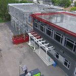
Augmenting Drone Videos could Facilitate Construction Monitoring
Augmented reality is a fascinating technology that could change the way we live and interact with the world that surrounds us. Unfortunately, we don’t…
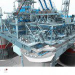
Creating Real-time Navigable 3D Infrastructure Models
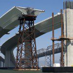
Designing successful infrastructure projects is one thing. Communicating and demonstrating those designs to clients and other stakeholders before construction is another. Bringing a design to life for people without a civil engineering background is always…
New AVEVA Engage Redefines Engineering Decision Support
Dubai, UAE, Oct. 21, 2015—AVEVA today announced AVEVA Engage, a unique collaborative decision-support solution for capital projects and operating assets. It combines the power of instant access to a Digital Asset’s full contextually-integrated information…

Infrastructure Innovation: Developing Creative AEC Solutions with Drones
Drones are one of the technologies most likely to really “take off” and have a significant impact on our industry. Whether referred to as unmanned aerial vehicles (UAVs), unmanned aircraft systems (UASs), remotely piloted aircraft, robots or drones, they’re…
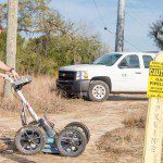
Reality Computing Goes Underground with Ground Penetrating Radar
Ground penetrating radar (GPR) is a non-destructive method for locating and mapping underground objects by transmitting high-frequency radio signals into the ground that bounce back when they hit a buried object or a boundary between different material types.…

Managing the Model: “We Can Do It Faster the Old Way”
I've been hearing the title of this column, in one form or another, from engineering and architectural design firms for more than 20 years. I hear it from drafters, designers, engineers, architects, principals and owners, and it's usually in response to why…
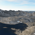
Exploring Reality Computing for Civil Infrastructure
New Reality Computing technologies that capture the physical world digitally and deliver digital information physically are changing the design, production, and management of products or projects—from cars to factories to highways. Civil infrastructure projects…

Preparing Today’s Students to Create a Smarter Tomorrow
There is a great deal of buzz in recent years about the concept of “Smarter Cities.” Despite increasing numbers moving to urban areas, there is significant concern that our nation’s infrastructure still ranks woefully behind the rest of the world in…
