
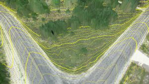
Contour lines at bare earth from Zenmuse L1 data AARSCHOT, Belgium – Virtual Surveyor has developed an enhanced point cloud workflow for Version 8.3 of its drone surveying software that allows users to take full advantage of the new LiDAR payloads…

Ideate Software Website Now Available in Six Languages
San Francisco, CA – Ideate Software, an Autodesk® AEC Industry Partner and Autodesk® Authorized Developer, announced that its website, www.ideatesoftware.com,…
BIMrx™ 3.0 Offers a More Intuitive UI and Powerful Modeling Features with Automation of Common Tasks through BIMrx Integration with Cloud Manager™
Nashua, NH - Global BIM and EAM consulting firm Microdesk, a leading provider of business and technology services for the design and construction industry,…
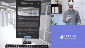
Prospect by IrisVR Creates End-to-End Coordination for BIM Teams with New Immersive Issue Tracking Feature
Portland, OR – Today, VR/AR collaboration platforms IrisVR and The Wild announced their official support for immersive end-to-end issue tracking in IrisVR‘s flagship product, Prospect. This product update allows for a full-cycle coordination workflow for…

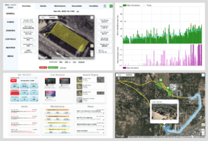
Spacewell Releases Opportunity Simulator for Offices
New analytical dashboard dynamically simulates space optimization scenarios and calculates space savings Supports CRE and workplace leaders to leverage the massive opportunity to optimize the office footprint and configuration (mix of workstations/collaboration…
AirData and UgCS New Integration
Today, SPH Engineering and AirData UAV have announced a new partnership to offer pilots a seamless and simple way to track and manage their fleets by automatically synchronizing flight data from SPH Engineering’s UgCS to AirData. "Thanks to the new AirData…
IntelliCAD Technology Consortium Announces Release of IntelliCAD® 10.1
Portland, OR, USA — The IntelliCAD Technology Consortium (ITC) today announced the release of IntelliCAD 10.1. IntelliCAD 10.1 is a major release that includes significant performance improvements and new features. IntelliCAD 10.1 is up to seven times faster…

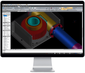
3Dconnexion Adds Full Support for Kubotek Interoperability Programs
Norwalk, Conn., August 16, 2021—3Dconnexion is proud to announce their certification of full support for their motion controller devices in the latest releases of the next-generation Kubotek interoperability programs. Kubotek’s K-Compare and K-Display…
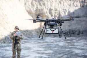
RedTail LiDAR Systems Unveils Innovative LiDAR System for Small Drones
Fairmont, WV - RedTail LiDAR Systems, a leader in microelectromechanical systems (MEMS) mirror-based LiDAR technology, today unveiled the market introduction of the RTL-450 LiDAR sensor. The product will be launched at the XPONENTIAL 2021 Trade…
NV5 Geospatial Debuts Predictive Modeling Platform to Improve Utilities’ Vegetation Management Programs
August 25 Webinar to Highlight How Analysis of Lidar and Historical Data Can Help Electric Utilities Improve Reliability and Reduce Costs by Identifying Areas for Proactive Trimming and Removal HOLLYWOOD, Fla. – NV5 Geospatial, powered by Quantum…
