

U.S. Department of Transportation sent this bulletin at 04/29/2021 11:00 AM EDT National Transportation Atlas Database Spring 2021 Includes New Pipeline Dataset, 8 Other Updates The Spring 2021 update to the National Transportation Atlas Database (NTAD) was…
Bentley Systems Announces Acquisitions of sensemetrics and Vista Data Vision, Leaders Respectively in Software for Infrastructure Instrumentation and Sensor Management
To Accelerate the “Infrastructure IoT” Opportunity, for Living Digital Twins! EXTON, Pa. – Bentley Systems, Incorporated (Nasdaq: BSY), the…

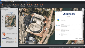
Hexagon’s HxDR to host 3DNL, Cyclomedia’s Digital Twin of the Netherlands
Cyclomedia's 3DNL, a complete digital twin of the Netherlands, is collected with the Leica CityMapper-2 and hosted on HxDR. Hexagon provides Cyclomedia…

5G Promises to Revolutionize Water Management on the Inevitable Road Towards Digital Transformation
5G to take off definitively in a large number of countries this year 29 April, 2021. 5G is set to transform the way mobile networks are designed and the way they are used, going way beyond simply improving the functionalities offered by 4G. Thanks…
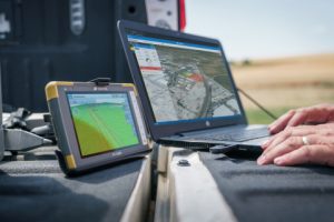
Latest Topcon Construction and Survey Software Available Now for Compatible, Comprehensive Connectivity
LIVERMORE, Calif.- Topcon Positioning Group announces the newest release of its suite of software for construction and survey professionals. MAGNET 7 is designed to utilize the strength that cloud-based connectivity can play in streamlining workflows through…
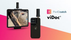
Pix4D launches survey-grade 3D modeling on mobile devices with RTK accuracy
Lausanne, Switzerland, [April 27, 2021]: Pix4D, the industry leader in photogrammetry, announces today the commercialization and worldwide exclusive distribution of the viDoc RTK rover, enabling ground-based RTK-grade 3D scanning with iOS mobile phones and…

Introducing NavVis IVION Core, a reality capture platform that adds more value to buildings and assets
Previously known as NavVis IndoorViewer, NavVis IVION Core is a reality capture platform for laser scanning and AEC professionals to manage their 3D scans with ease. NavVis IVION Core enhancements include multi-site functionality, updated user management,…

Rand Simulation Launches Program Which Enables Customers to Achieve Faster ROI and Adoption of Ansys Products
Baltimore, MD – Rand Simulation, a division of Rand Worldwide, is proud to announce that they have launched the Ansys Development and Ongoing Proficiency Training (ADOPT) program. As an Ansys Certified Elite Channel Partner, Rand Simulation developed…

New Degree at Husson University will Prepare Students for Careers as Extended Reality Professionals
New Bachelor of Science in extended reality (XR) degree to produce specialized virtual and augmented reality professionals who are ready to meet the demands of research and entertainment organizations, educational institutions, and industry. BANGOR,…
Plex-Earth expands to BricsCAD to empower AEC professionals with premium satellite and aerial imagery
Plex-Earth, a full-blown popular platform for AutoCAD that brings the world’s largest aerial and satellite imagery providers under a single umbrella, now expands its offering to BricsCAD, to inform smart engineering with recent, historical, high-quality…
