
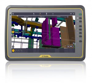
Trimble released Trimble® Field Link version 4.0, the latest version of its construction layout software for measuring and creating layout positions for anchor bolts, hangers, cable trays and other common construction layout tasks. With new modular software…

Trimble Reports Third Quarter 2016 Results
SUNNYVALE, Calif. - Trimble (NASDAQ: TRMB) today announced financial results for the third quarter of 2016. Third Quarter 2016 Financial Summary Third…

Senet and Trimble Enable Water Monitoring Solutions throughout North America
PORTSMOUTH, N.H.- Senet, the first and only North American provider of public, low-power, wide-area networks (LPWANs) for long range-based (LoRa®-based)…

Trimble Expands 3D Laser Scanning Portfolio with Addition of New TX6 and Improved TX8
HAMBURG, Germany - Trimble (NASDAQ: TRMB) introduced today its new Trimble® TX6 and improved TX8 high-performance 3D laser scanning solutions. With a fully integrated High Dynamic Range (HDR) camera and Wi-Fi remote control, the high-speed 3D laser scanners…

Trimble Sells its Unmanned Aircraft System Business to Delair-Tech
SUNNYVALE, Calif. — Trimble (NASDAQ: TRMB) announced today that Delair-Tech has acquired its Belgium-based Gatewing Unmanned Aircraft System (UAS) engineering and manufacturing business. Delair-Tech is a leading provider of long-range, fixed-wing UAS solutions…
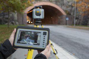
Trimble Unveils SX10 Scanning Total Station for Surveying, Engineering and Geospatial Professionals
SUNNYVALE, Calif., - Trimble (NASDAQ: TRMB) unveiled today a next-generation survey instrument—the Trimble® SX10 Scanning Total Station. It merges high-speed 3D scanning, enhanced Trimble VISION™ imaging technology and high-accuracy total station measurements…
Trimble Connected Mine Provides Spatial Data Visualization Using Trimble and Microsoft Mixed-Reality Technologies
SUNNYVALE, Calif. —Trimble (NASDAQ:TRMB) announced today the release of its Trimble® Connected Mine™ Visual Intelligence module with support for mixed-reality technology including Microsoft HoloLens to provide visual collaboration of mine spatial data.…
Buckeye Mountain and Trimble Partner to Bring Mobile Computing, GPS and AEI Tag to Railways
NIWOT, Colo.- Buckeye Mountain and Trimble have been working together in an effort to provide the railroad industry with products that meet their specific needs for mobile computers, AEI (railcar automatic equipment identification tags) and GPS. Trimble's…
Mapping Local Resources Helps San Jose Battle Food Insecurity
Food security is a growing social and economic challenge that knows no political boundaries. Even in the United States, an astonishing 18 million households were labeled ‘food insecure’ in 2011 because they lacked the means at some point during the year…
